| Most viewed |
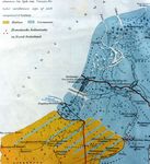
A Roman Era Map of Belgica c. 50 B.C.2113 viewsCelts north & east of the Rhine (Holland/Ger-many) were overrun by Germanic tribes (blue) who then made inroads (blue lines) into Celtic lands (yellow) in Belgium & North France forcing Celtic tribes southwest, the one encroaching on the other, while Caesar's legions overran Celtic Gaul, turning it into a vast Celtic cemetery.
|
|
1531 viewsDun Bulcaun's massive Manapi marine entrepot ringfort, which gave Dunbulcaun Bay its name, standing at the mouth of the stone-revetted Ballynamanagh River docks, one of many in Ath Clee Magh Ri's Iron Age sea-port. Others were Caher na Managh, Rath an Aonagh and Rath Mor.
|
|

1039 viewsMany embankments were preserved as winter platforms for farm animals in wet lands - in Benmore/Benbeg E of Turoe & Cor-na-mucladh near the River Suck northeast of Ahascragh.
|
|
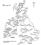
Ptolemy's Amended British Isles c. 150 A.D. 867 viewsBelgic tribes in England & Ireland: Manapi & Bri-gantes in SE Ireland, Atrebates (Gangani) in W Ireland's Shannon estuary & in Connacht where they set up 'Regia E Tera' (Capital at Turoe/ Thuroit), 'Nag-na-tal' (Knocknadala) & 'Aut-ein-ri' (Athenry/Ait Regia) of Ptolemy's 'map', surrounded by their Belgic defensive system.
|
|

Ptolemy's 1st/2nd cent. 'Map' of Ireland819 viewsThe incorrect clockwise reading of Ptolemy of Alexandria's (c. 100 A.D.) West of Ireland data (left) as generally, albeit erroneously, accepted by many authorities, contrasted here with an amended, fully recognizable, West of Ireland map, with all data in correct order based on a rational left-to-right, top-to-bottom, reading of Ptolemy's record (right). The misplacing of the Shannon and Dur (Dughiortach/Dunkellin) River mouths are the key to the correct reading.
|
|
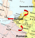
659 viewsCaught in a pincer-movement between invading Germanic tribes & advancing Roman legions in Caesar's day, anti-Roman factions of several Belgic tribes fled to SE England & the southern half of Ireland. Roman legions snuffed out Celtic autonomy across Europe. "They rob, kill & rape and call this 'Roman Rule'. They create a desert called 'Peace'" (Calgacus, quoted by Tacitus).
|
|
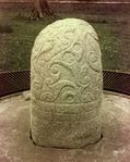
540 viewsFinest example of Celtic La Tene stone art in all of Europe, the Turoe Stone, at the core of the Turoe/Knocknadala oppidum defensive system of linear embankments. Fir Belg Overkings abandoned the Turoe/Knocknadala oppidum core following Maine Mor & his Ulster forces' 5th cent. invasion of Hy Many in the SE of Connacht.
|
|
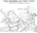
Queen Medb's Tain Bo Cuailgne Route539 viewsArchaic placenames on Queen Medb's earliest Tain Bo Cuailgne route (i.e. Fidh Cunga forest where Cormac Ullfhota repaired his chariot) show it ran east from Athenry's Rath Cruacha where she reigned, not south from Rathcroghan of Roscommon where her fiercest enemy, Cuscraid, son of Conor Mac Nessa, reigned.
|
|
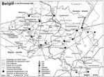
The Changing Map of Celtic Belgica487 viewsCeltic Manapi, Morini & Atrebates were driven SW into Belgium, N France & SE Britain. The Morini lost Kassel Morinorum to the Manapi who then renamed it Kassel Manapiorum. The Atre-bates lost Thuroit and established Thouruanna & Ait Regia (Atrecht) near Belgium's upper Door River. Advancing Roman legions forced these Belgic tribes to devise & erect an elaborate Belgic defensive system around their Capitals.
|
|

The Illustrious Turoe Stone472 viewsThis most magnificent example of Celtic virtuos-ity in archaic abstract stone art in existence, done in a cruciform pattern (left), is the Turoe oppidum's unique, celebrated, ornate ritual granite monolith, "covered with continuous abstract curvilinear La Tene art with flowing design set off by a band of Greek-key decor-ation surrounding its foot. Celic art is truly art for art's sake" (Professor Etienne Rynne).
|
|
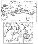
Commius' (Gan's) British Belgic Oppidum466 viewsCeltic SE England ruled by Commius (Gann, top). Chichester oppidum (lower), the last to fall as Commius' Belgic followers fled to Ireland. Belgic capitals, surrounded by linear embankments, were called 'oppida' (oppidum) by Caesar.
|
|

Queen Medb's Tain Bo Flidhais Route463 viewsLike her Tain Bo Cuailgne route, Queen Medb's Tain Bo Flidhais route set forth from Galway's Fir Belg Rath Cruacha of Athenry oppidum, not from the alien Roscommon Cruthin Rathcroghan centre as 9th century & later pseudo-historians alleged in their fictitiously manipulated efforts to glorify Rathcroghan which was still a satellite outpost of the extensive archaic province of Ulster in Queen Medb's own day and the seat of her most antagonistic Cruthintuatha enemies.
|
|
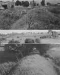
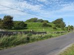
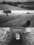
Irish Belgic oppidum embankments432 viewsInner-ward dykes around Athenry (top). Turoe set of embankments, one forming the lower field fence, another across the slope of the 2nd field up (centre). 24 ft wide avenue-like transverse dyke (lower) across this Turoe inner-ward set.
|
|
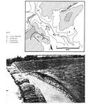
Dykes of the Belgic defensive system423 viewsSoutheast England's Devil's Dyke, Beech Bottom and Prae Wood Dykes at Verulamium oppidum, St. Albans, north of London (map). Thickthorn Dyke (photo): a section across multiple dykes in Dorset (map and photo by D. W. Harding).
|
|
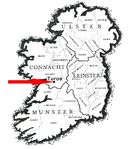
416 viewsArrow points to Turoe of Galway in W Ireland, Ptolemy's 'REGIA E TE[MH]RA': given variously as Temhar Bhru Nuadhat, Cnoc Temhroit, Rigrad Temhroit & Thuroit de Fearaibh mBelg in sundry archaic Irish texts, literally echoing the former Continental Belgic Thuroit/Theruanna - c.f. the Map of Belgica (at the top of this photo file) .
|
|
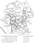
Receding Ulster Boundary409 viewsThe archaic Province of Ulster extending well into E Connacht & its receding boundaries as the Connacht Fir Belg (Fir Ol nEgmacht) overran the Ulstermen (Cruthin/Ulaid) over several centur-ies to its final boundary along the Boyne River, the Danes Cast to Loch Neagh & the Bann River.
|
|
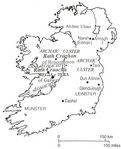
Archaic Connacht & Ulster404 viewsQueen Medb's Ol nEgmacht (archaic Connacht) province vis a vis ancient Ulster of which N Leinster & NE Connacht (Tara & Rathcroghan) were still a part into the early historic period.
|
|

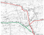
M6 Motorway Impact on Oppidum Complex371 viewsThe route of the M6 motorway & its link road to Loughrea (red lines) superimposed on the line-drawing on a map indicating the inner-ward set of linear embankments surrounding the Turoe/ Knocknadala oppidum core signifies what an irrevocably disemboweling impact it assuredly has on this unique archaeological landscape.
|
|
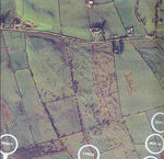
359 viewsAerial photo of segment of Cetni's urban-like complex in Turoe/Knocknadala oppidum core gives a graphic picture of what a much more extensive multi-townland area looked like before land reclamation. "The Belgae created urban settlements which were towns" (Dr. Anne Ross, 'The Everyday Life of the Pagan Celts', p. 32)
|
|

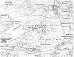
Turoe Oppidum Inner-ward Outline Map356 viewsA set of 3 parallel embankments encircled Turoe Hill's extensive summit. Dark lines represent sur-viving vestiges, lighter lines represent trace-able sections or those remembered by elders. Knocknadalla Hill was similarly circumvallated. Together the 2 hills formed one oppidum core.
|
|
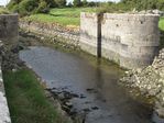
352 viewsThe finely-cut stonework of the floodgates at the mouth of the 2000 year old embanked and stone-revetted Ballynamanagh River where Iron Age Manapi sea traders docked their leather-sailed longships will most certainly dissappear unless it is promptly placed under Preservation Order.
|
|
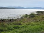
349 viewsGalway's Ath Clee Magh Ri, Ireland's chief Iron Age seaport through which it was often invaded. Mac Con led his invasion here (a bridge of ships all the way from Scotland's Port Ri). He assassin-ated King Art, Eoghan Mor & a host of others to usurp the Fir Belg kingship as Ri Temhro (Turoe)
|
|
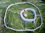
Widespread Evidence of a Celtic Invasion345 viewsMassive beach-head & 14 ft wide stone forts stand along Ireland's W Coast, 400 in Clare alone & numerous others along Galway & Mayo coast, many named after the Belgae (Dun Belg, Caher Belg) or their Invasion Leaders (Dun Aengus, Dun Irgus, Dun Iumhor, Dun Mod & Dun Oghil (above, one of the smallest) underpinning a widespread Iron Age Celtic Belgic invasion of W Ireland.
|
|
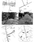
311 views1892 O.S. 25" Map has 3 lines for linear, 2 for transverse (top A), 2 for single (top B/photo), 4 for full-width dykes (lower; roads along dyke fosse on E & W flanks of Turoe's inner ward).
|
|
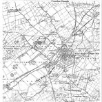
306 viewsAthenry's four Cruachan (necropoli) zones (Na Cruachna; Mountain North, South, East & West). Sli Mhor highway ran WNW from Turoe to Ath-enry and then WSW to Ath Clee Magh Ri/Clarin-bridge Iron Age sea port. Ait an Ri (Athenry) and Temhroit (Turoe) echo Continental Ait Regia (Atrecht) & Thuroit, names the Fir Belg brought to W Ireland, cf. Changing Belgica Map above.
|
|
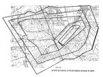
302 viewsKnocknadala (Assembly Hill) summit inner ward dykes opened out to encompass an urban comp-lex on its W & NW flanks. Its 40 acre Cetni seg-ment is under Preservation Order by the Nat-ional Monuments Department. Adjoining 'urban' areas were razed by earlier land reclamation.
|
|

Queen Medb's Magic-Boar Chase289 viewsIn Queen Medb's mythological wild-boar chase around the plain of Magh Muc Dhruim (Athenry) the magic boar was transmogrified (foreground - inset frontal view of stone pig) when speared above the Dur River (Dughiortach) near Esker. The Rot na Ri royal road ran atop the esker ridge passing in front of Ratgorgin Castle beside Ailech Gorgin fort whence Corc (Gorgin) led the Deisi tribes to establish Cashel of Munster.
|
|

288 viewsThe artistic skill lavished on this Stone of Destiny ("borne by Briganten Tuatha De gods under King Nuadha who ceded Connacht to the Fir Belg", Lec 185; K 121b), elevating the dynamic energy of Celtic symbolism to its zenith, underpins its vast ceremonial/ritualistic significance and Turoe's (Temhar Bhrugh Nuadha's) unique importance.
|
|
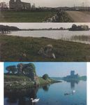
Royal Sites of Connacht283 viewsMaine Mor's invasion led to Turoe's demise & the rise of 2 Galway dynasties at new sites vying for Connacht's control, Ui Fiachra King Guaire at Dun Guaire, Kinvara (lower) & Ui Briuin kings on Loch Seola crannog (centre) with Domhnach Mor Magh Seola SW of Tuam as their Basilica (top)
|
|
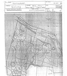
Cetni Sprawling Urban Settlement280 viewsCetni urban-like area put under Preservation Order. Rot na Ri at NE corner (parallel to road) swings west from Knocknadala & heads straight to Galway's Iron Age seaport of Ath Clee Magh Ri. A vast 'Cruachan na hUaigneanna' ancient cemetery overlooks Cetni's S flank (not shown)
|
|
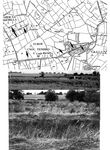
279 viewsArrows on the O.S. map point to vestiges of a set of parallel inner ward linear embankments along the northern (top photo) and southern (lower photo) slopes of the extensive Turoe hill.
|
|
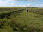
276 viewsArchaeologist surveying a fragment of the ancient Sli Mhor highway across Ireland (it is 28 ft. wide, excluding plump embankments, twice the width of the famous contemporary Via Appia Roman Road) as it heads straight into Athenry and through it. The extension of this fragment in the fields to fore and aft was buldozed away into oblivion in living memory.
|
|
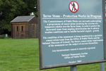
Turoe Stone's Ominous Obsequies275 viewsThe illustrious Turoe Stone silenced, entombed (in the tiny hut at left) and hidden from the eyes of busloads of tourists who come from afar to see this wonder of the ages, as the powers-that-be plan to rob Turoe of its touchstone of truth and deprive it for evermore of this key to its ancient heritage, hammering home the final nail into the coffin of Ireland's Iron Age history.
|
|
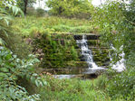
273 viewsIdyllic weir & millrace beside Rath na bhFhille (Poet's Palace), where poets honed their verse for Feis Temhro contests, & an adjacent water-mill originally erected by King Cormac Mac Art to save his paramour, Ciarnait, from the task of grinding corn by hand quern, as legend tells, with food outlets, to cater bountifully for honor-ed guests at the Great Assembly (Feis Temhro).
|
|
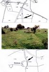
272 viewsToll-gate-like Tonawausa fort (lower map) right on Sli Dala (photo) overlooking its S entrance to Turoe coming from Ballygasty (Loughrea) (top).
|
|

Galway Bay's Ath Claidh Magh Ri Seaport269 viewsGalway's Dunbulcaun Bay & its rivermouths form the Iron Age seaport of Ath Clee Magh Ri, the "chief sea port through which Ireland has most often been invaded" ("gur ab e an cuan so aon-chuan gabhala na hEirionn mar do frioth a n-ar leabhraibh oir is ann is mionnca do hionnsuighe Eire riamh", Ston. A. p. 125). Manapi marine communities (Bally-na-Managh) settled here & set up Stradbally towns & a string of 'Managh'/ 'Mannin'/'Mann' Tlds inland along the Sli Mhanann (Manapi road) through Magh Colla Mann (Moy-cola of the Manapi) to Loughrea Lake (Lind Lir).
|
|

Magh Adhair in South Clare268 viewsMagh Adhair's inauguration mound within a saucer-like surround & its banked stream (lower left) with floodgates & cutting (lower right corner) to create an artificial lake round it.
|
|
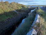
266 viewsA classic example (above) of the many Ath Clee Magh Ri rivermouth docking piers around Cla-rin/Kilcolgan bridges, Mweeloon, Tawin & Strad-bally quaysides, Brandy harbour, Belmuckinish Channel and Ballynamanagh River in Dunbulcaun Bay in greater Galway Bay area where Manapi flat-bottomed, leather-sailed longships berthed or moved on into artificially flood-gate-raised Seafield/Ballynamanagh winterized lake havens.
|
|

265 viewsLinear embankments E of Turoe - one partly cut and laid out for an aborted railway line (top).
|
|

Turoe Oppidum Linear Embankments264 viewsVestiges of 2 parallel linear embankments of the inner ward set run across the N slope of Turoe, one forming the lower field fence behind the flock of sheep, the second across the centre of the 2nd large field up from lower dyke. These encircled the perimeter of Turoe hill. An outer set of dykes fused Turoe hill & the adjoining Knocknadala hill into one oppidum core.
|
|

Fearta Necropolis on the slopes of Turoe264 viewsPanoramic view of the central segment of the extensive Turoe hill encircled by an inner ward set of linear embankments. The original site of the Turoe Stone was just to the right of the fir trees standing out at centre of the top left half of photo. The fields with sheep & cattle grazing are known as Fearta Tld., one of the Royal Cemeteries on the N & S slopes of Turoe Hill.
|
|
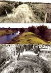
259 viewsEmbanked streams and rivers were a strategic part of the Belgic (Fir Belg) defensive system.
|
|

257 viewsRahally's historic hillfort dykes are 25 ft. wide at ground level, comparable to the Belgic defensive system embankments. The hillfort dyke fosse is shallow & narrow compared to the Fir Belg fosse which was 12 ft. deep & wide. The hillfort dykes did not have an outer lip embankment; the later Belgic defensive system embankments had one. There were few finds due to deep mechanical removal of topsoil, contrary to best practice.
|
|

256 viewsSections across dykes by NRA M6 road archaeol-ogists date Rahally hillfort to 1000 BC, 1000 yrs older than the Fir Belg embankments that wed it to Turoe oppidum's Belgic defensive system. The Fir Belg leader, Cing (al. Cung) set up residence on its historic summit, surrounded by Belafa's ancient forest named Fidh Cinga (Fidh Cunga) after him (as mentioned in the archaic "Togail Bruidne Da Choca" saga). Conan Mac Morna & the Mac Lane Fir Belg (Tuar Mac Lane) clans left their Iron Age names on adjacent townlands.
|
|

Rahally's Vast Unique Rare Trivallate Hillfort254 viewsBelgic defensive system linear embankments sur-rounding Turoe/Knocknadala oppidum ran up to & interlinked with the earlier embankments of the exceptionally rare form of Rahally trivallate Hillfort, its unique significance not recognized in the Environmental Impact Assessment process. Excavation & sections across embankments were done by NRA archaeologists before the blatantly deliberate laying of M6 motorway through it.
|
|
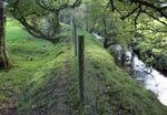
249 viewsA built-up embankment along the edge of a stream in Kiltulla North. This was very common occurence especially in low lying areas where streams were embanked & fitted with flood-gates to flood wide areas in times of danger.
|
|
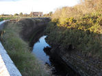
248 viewsSeveral intact 2000 year-old stone-revetted, embanked stretches of smaller river inlets run inland for long distances to now-drained inland lakes underpinning the late Iron Age need for extensive secure sheltered havens for a very large fleet of Manapi merchant ships in Iron Age Ath Clee Magh Ri's Manapi (Managh) mariner townlands around that renowned Dunbulcaun Bay ancient seaport in the greater Galway Bay area.
|
|
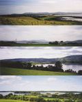
245 views'Dindshenchas Ath Chlaidh (Clee) Magh Ri' says of its linear embankments "O na claidhbha-sin anme is Ath Claidh co treise trebh" ("These embank-ments give its name to densely populated Ath Claidh Magh Ri" (Clarinbridge) - 2 top photos). Lochs Cutra and Greine among many lakes in Turoe's oppidum defensive system (2 lower).
|
|
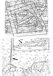
244 viewsLinear embankments expanded out from Turoe/ Knocknadala (top O.S. map) & encompassed the mini Athenry oppidum as this Fir Belg primary settlement area expanded apace (each set of 3 parallel embankments is represented by 1 line). Compare the one mile defensive dyke on the O.S. Map (middle insert) through Cormacuagh West/ Clough Tlds. with a more lengthy stretch of embankment across the S of Carnakelly North bog and swinging N along the Carnakelly North/ Cloonkeenmore South west boundary (bottom).
|
|

242 viewsThe Raford River (An Dughiortach, the 'Dur Fluvium' of Ptolemy's record) is another classic example of an embanked river equipped with flood gates to inundate extensive low-lying areas and enhance the Belgic defensive system of the Turoe/Knocknadala oppidum. Flooding was intended to be used only when threatened with invasion. This is but one of numerous examples.
|
|

241 viewsCian, A Scail & Aine's (Danu) Abodes in Mountain East (Esker area between Turoe & Athenry); Bru A Scail (Dominic's Hill, top far left), Cruachan Aine (mid distance), Cruach Chian (hidden by Bru A Scail) & Mountain West (Cruachan Thiar), South and North formed Turoe/Athenry's (not Roscommon's Rathcroghan) vast Releg na Ri 'sidh' complex: "Sidh Chonnacht is ed Sidh nOchaill (SW of Athenry) is ed Sidh Boidb (Boyhill, over-looking Athenry from S) is ed Releg na Ri lamh le Cruachain" ("the pre-eminent Royal Necropolis of Pre-Christian Ireland") as clearly related in 'De Chophur in da Mucado' & other archaic texts.
|
|
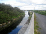
241 viewsBallynamanagh's embanked & stone-revetted river mouth fitted with floodgate piers, one of several in Dun Bulcaun Bay where "swift ships sail-ing the high seas frequented Ath Clee Magh Ri in Galway of the harbours" (LL 192a: "na luing lathar ngle o Bun Gallmhe glanuaire o Ath Clee i nHerut uill", the great Iron Age sea port of Turoe/Knocknadala/Athenry oppidum in Ma-ree/Clarinbridge/Kilcolgan's Ath Clee Magh Ri).
|
|
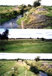
234 viewsTuroe's Doosigh (Dyke) stream is a classic example of an embanked defensive stream.
|
|

234 viewsFrom top: Linear dykes through Baunoge/ Tonaroasty to Knockadikeen E of Loughrea; in Rathgorgin/Kilconierin SE of Athenry; in Killimor; and along Galway/Mayo border.
|
|
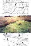
233 viewsSli Mhor highway fragment shown on O.S. Map. A sample of stretches of modern road approach-ing Athenry built on the Sli Mor - lower map.
|
|

Ath Clee Magh Ri Seaport in Dun Bulcaun Bay232 viewsSailboat off Ballynamanagh (left) & Clarin (top left) rivermouths, & Kilcolgan's (right). Weirs (such as Weir Village/Roymore) & locks raised river levels (3rd-5th cent. sea levels were 4 to 6 ft higher than now) for ship building in Manavau-ghan (Manapi Forest) & inner docks near Caher-forvaus (Sailor's Haven) & Cahermor at Raha-shane (Durloch) lake & Foircoill (Sailor's Haven Wood) lake in Ochall (Fhochoill) Oichne whence St. Patrick sailed when fleeing from slavery.
|
|
231 viewsRingforts are regular features along the linear embankments. Spacious manmade caves over-look the linear embankments where ringforts were absent, as here in Loughrea Golf Course.
|
|

231 viewsIntact fragment of linear embankments along low hill-brow over the Dughiortach River in Beech-hill/ Skehanagh area, one of many well preserved embankments so totally overgrown with thorn-bush as to be almost impossible to photograph.
|
|

Rath na bhFhille Palace of the Poets229 viewsThe large Rath na bhFhille (Palace of the Poets) fort in Raford ("Rath na bhFhille Droichead") beside the Dughiortach/Dur River at the NE foot of the Knocknadala/Turoe hills where honoured poets were guests while participating at poetic and historic contests held at Abber na bhFhille (Poet's Arena) at the oppidum core during the annual/tri-annual Feis Temhro Festival inaugur-ated by the leader of the Fir Belg Invasion of Ireland, Dela, grandson of Commius (Gann) who led the Fir Belg tribes to the Shannon estuary.
|
|
229 viewsFollowing Caesar's genocide of the Celtic Veneti, Manapi mariners took over the lucrative sea trade (Irish Sea named Muir Mann after them). In Ath Clee Magh Ri (Map) traces of their potent presence survive in fort, forest, river, road & place names - Caher na Managh (Manapi fort), Dun Manannaun (shrine of their sea-faring god), Manavaughaun (Manapi forest), Sli Mhanann (Manapi road) & many Mannin & Managh Tlds. Toberorsaun Altar at Dunkellin (Cethelen - sea goddess)/Kilcolgan inner river mouth mirrors the Manapi ngChethelennia votive altar at the Rhine/Schelde (Ascaul) river mouth in Holland.
|
|

228 viewsLugh requested entrance to Feis Temhro. When asked "What art do you practice, smithy, poet, warrior? We have Coolan the smithy at Cruachu Coolain (above), Ogma, the god of poetry, Dian Cecht, god of healing, etc. (all in Turoe's zone, not Tara's), he revealed he was god of all arts. Nuadha, the King of the old gods, ceded Brugh Nuadhat to Lugh. Lugh sprung over Temhar's multiple embankments (set at Turoe, not Tara) & made Nuadha's Abode his own" Lugh Bhrugh ('Cath Magh Tuired' is pseudo history's subver-sion of Magh Temhroit). King Eochaidh Ferach Mhor installed Lugh, the most renowned Contin-ental Celtic god, as the tutelary god of Turoe.
|
|
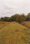
227 viewsVestige of a transverse dyke across the set of inner ward embankments encircling Turoe.
|
|
226 viewsSli Mor & Sli Dala (Bb 203b) converged on Turoe (Temhar)/Knocknadala, not on Tara. Sli Mor on the Escir ridge from the E Coast to Knocknadala (N6 motorway being cut through it) skirted its summit, zigzagging through inner-ward embank-ments & ran WNW to Athenry & SW to Ath Clee Magh Ri port through which Dela led his Fir Belg invasion to Turoe/Knocknadala where he inaug-urated Feis Temhro (Dindshenchas Cnoc na Dala/ Sliabh Bladhma). He built Sli Dala (Ll 169, 190; K 122, 129; Sas 700; Of 314) road from there to Roscrea. Royal Rot na Ri road ran W from Turoe through Magh Fot straight to Ath Clee Mag Ri.
|
|
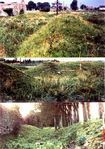
225 viewsKing Eochaid Ferach Mhor commissioned Tinni Mac Conrach and his Domnann tribe to erect Athenry's Rath Cruacha linear embankments (the town's N wall stands on a segment; lower photo). He later enthroned his daughter Medb as Queen of Ol nEgmacht there. Medieval pseudo-history transplanted Eochaid to Tara and Medb to Rathcroghan of Roscommon (Ref: Eriu ii, 178).
|
|

The Tuatha De gods of the Fir Belg Pantheon225 viewsThe Fir Belg tribes brought their gods to Magh Temhroit (pseudo Mag Tured). Dagda, Other-world god of wisdom, assigned their Abodes in Turoe, not in Tara, region: Lugh to Lugh Bhru, Bodb to Sidh Boidb (Boy Hill, Athenry), Manan-nan to Loch Corrib, Lir to Loughrea Lake (Lind Lir); the twin peaks, Bru A Scail (Dominic's Hill, top) & cone-shaped Cruach Chian (lower: gutted by gravel mining), bosom of the gods, to Cian & A Scail; Ogma & Brighid to Sheeaun, Nuadha to Temhar Brugh Nuadhat (variant 'Niat/Nudd') on Turoe; K 121b, 137a; Rc xxi, 152; Lec 190), etc.
|
|

224 viewsBallynamanagh floodgate-raised River enabled Manapi flat-bottomed, high-prowed, leather-sailed longships reach the Sli Mor's Black Rock terminal through the former Ballynamanagh Lake skirting Seafield, Monroo/Pollnadoobhaigh dykes (A Winter haven). On the right bank stands the massive marine Dun Bulcaun emporium fort; on the left bank is Dun Manannan temple fort where sailors paid homage to Manannan, guardian sea god of sailors, before & after their sea voyages.
|
|
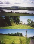
Expanding South into North Munster222 viewsLinear embankments on the brow of a hill above a road built along the fosse of a lower parallel dyke on Galway/Clare border (lower photos). Co. Clare's Loch Greine (top) was incorporated into the Turoe oppidum defensive system as it expanded southward into Northwest Munster.
|
|
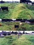
222 viewsEochaid Ferach, the "Ideal King of the Fir Belg", erected Athenry's Magh Muc Dhruim inner ward embankments (outside or underneath the town walls), a classic example of Southeast England and Continental Belgic defensive systems. Local tradition has always claimed that these & similar outer ward 'dun cladh' multiple sets of defensive dykes were erected by the Fir Belg (Belgae).
|
|
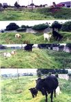
222 viewsAthenry's inner ward embankment enclosure of Rath Cruacha. Queen Medb erected similar sets of outer ward embankments as told in local Magh Muc Dhruim mythological wild boar chase sagas. Vestiges survive. Cattle give a visual idea of the height & width of the dykes in their present state of defacement. Sidhe Boidb (Boy Hill) & Lugh Bhrugh at top left corner of lower photo.
|
|
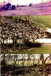
222 viewsAthenry's ancient Sidh Boidb cairn cemetery (Boy Hill, named after Bodb, King of the gods of pagan Ireland) & its associated cemeteries are equated in archaic texts with Ireland's great Releg na Ri lamh le Cruachain cemetery (i.e. 'De Chophur in da Mucado', Book of Leinster).
|
|

222 viewsFrom Mannin Bay (S of Clifden) the Manapi cut off countless coastal, lake & mountain sectors (e.g Roundstone's Doolough/Letterdiffe [Leitir dooibhe] dyke: doo, pl. doobha = embankment) to husband huge flocks of geese, sheep & shells for the lucrative goosedown, wool and purple dye trade to wealthy Romans, as they expanded across South Connemara (named Conmacne Mara = hounds of the sea, after them) to Lough Corrib ("Manapi Sea"), pushing the Partrige & Mac Umhoire north, & making Ath Clee Magh Ri in Galway's Dunbulcaun Bay Ireland's great Iron Age Atlantic Harbour & major Manapi seaport.
|
|

217 viewsRoscommon/Galway border dyke near Creggs (top left); Newgrove, Kilreekill (top right, "wide enough for 2 lorries astride"); Killagh Mor/Beg (Escir gChlaidh); & Monivea dyke (bottom).
|
|

Royal Tumuli & Otherworld Abodes214 viewsBrugh Nuadha (later Lugh Bhrugh) on Turoe Hill (top). Cormac Mac Art's tumulus at Tample/ Cormacuagh (2nd/3rd). Carn Dhearmait (Mac Morna), Newcastle (2nd lower). Fert Medba, Queen Medb's recently desecrated tumulus at Rahard/Boyhill, close by Athenry (lower).
|
|
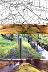
212 viewsArrows on O. S. map point to a 20 meter wide embankment (a railway line route was partially levelled along its fosse before being aborted - top photo) running parallel to the built-up banks of Raford River in Brackloon (lower photos), forming part of a set of Turoe/Knocknadala's oppidum outer-ward linear embankments.
|
|

212 viewsSections of the ancient Sli Dala raised highway, built by the Fir Belg Leader Dela, north & east of Loughrea on its route from Turoe to Roscrea
|
|
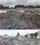
212 viewsSidh Boidb at Ard na Chruachna (top), the core of Athenry's Magh Muc Dhruim. 'Dindsenchas Magh Mucrama' (LL. 162b, 21559) tells its unique character: "Magh Muc Dhruim molas chac, clar i tat claidhibh cressa" ("Famed Magh Muc Dhruim, landscape of the dense linear embankments").
|
|
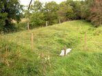
209 viewsA partly-despoilt inner-ward linear embankment over a stream (hidden between main & outer-lip embankment) along the southeast foot of Turoe Hill near the present site of the Turoe Stone.
|
|

208 viewsSection across main embankment (known as Lady's Walk) over a stream in Kiltulla North shows the outer lip embankment through the cutting. Built-up embankments over even small streams provided formidable defence lines in the outer wards of this Belgic defensive system.
|
|
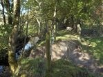
206 viewsEven small streams like the embanked Carnakelly stream above were commandeered into this classic linear-embanked Belgic defensive system (the outer-lip embankment has been levelled).
|
|

203 viewsBelafea "buaile" (cattle kraal NE of Turoe before (top)/after (lower) demolition, between Grange Hill ("grainsech" = granary) & Knocknabuaile. Sli Mor ran on the Escir Riada on the far boundary. Two other adjacent "buaile" survive, one, Boley-more, to the SE, and another, 'moated site', in Rathglass, east of Rahally Hillfort. All 3 were brought into Turoe's Fir Belg defensive system.
|
|

200 viewsSegments of the Sli Mhor running from Turoe to Athenry (lower) & SW away from Athenry (top) to Ath Clee Magh Ri seaport at Clarenbridge.
|
|

200 viewsPresent state of cairns denuded of their stone fill in Sid Boidb (Boy Hill, top) and Loo Bhroo (2nd from top) of Cruachan Theas (Mountain South) segment of Releg na Ri Necropolis over-looking Athenry town from the south. Many others were stripped of stone & levelled out.
|
|
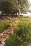
200 viewsThe curve of a Releg na Ri's cairn kerb-stone perimeter indicates the size of cairns in this renowned cemetery (pseudo history hijacked it for Rathcroghan of Roscommon) stripped of stone-fill to build the townwalls, streets, univer-sity, churches & houses of Norman Athenry.
|
|

M6 Motorway Destruction of Rahally Hillfort200 viewsThis M6 road cut through numerous vestiges of Turoe oppidum's linear embankment, under a cloud of blatant denial, and ancient cemeteries too, but also destroyed archaic Rahally Hill Fort (above: double banked/ditched ringfort in clus-ter of trees at its summit) on Turoe oppidum core's NE flank with this reckless ravaging gash deep through its heart. Modern Ireland could not care less what it bulldozes into oblivion now.
|
|

196 viewsThree-faced god, allegedly from a Turoe mound & cemented into a wall (3rd face hidden) may represent the Continental Tricephalus. In Irish tradition "in tEllen Trechend" three-faced god issued from the cave of Cruachan at Samhan (Hallowe'en) each year & burned the countryside with its breath, creating the winter landscape. This Turoe tradition too was transferred by pseudo history to Tara where it would have been anathema in that pre-Celtic Cruthin scenario.
|
|
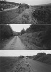
192 viewsRoads built along filled-in fosse of linear embank-ments high up in the Sonnagh (Dyke) Townlands of the Aughta Mountain Range (top & centre photos) in S Galway. The lower road was built along the surface of a straight, narrow linear embankment along the edge of the bog forming the east flank of Knocknadala Hill (lower photo).
|
|
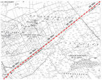
192 viewsCaheradrine's strategic massive 'toll-gate' entre-pot on the Sli Mor (there proudly proclaimed "Ireland's oldest highway") from Athenry SW to its Clarinbridge Black Rock terminal's outlet through Ballynamanagh River to Dunbulcaun Bay. From Caheradrine (al. Fidaci Regia, Fideg fort, where King Art was assassinated & Eoghan Mor of Munster based his Duhallow defenders, the Oga Bethra; Lec 164; Rc. xvii, 7; Ca 302; Laud 610) it diverged to Ath Clee Magh Ri wharves in Mweeloon Bay, Caher na Managh on Clarinbridge River, & Roy Mor, Dun Cethelen & Stradbally West Weir on Dunkellin (Dur)/Kilcolgan River.
|
|
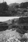
187 viewsCarn Cesra (Burial cairn of Ugaine Mor's Queen Cesair) on Cruach Magh Seolgha, N of Athenry in Galway (top). Tirechan alleged that St. Patrick blessed the lands of Connacht's Ui Briuin Kings from there. 'Rooms' allegedly prepared for Patrich in a satelite cairn (lower photo). Linear embankments ran along N & S slopes of the hill.
|
|

181 viewsRathgorgin's avenue-like embankments were ploughed up by animals, blown by winds & washed away by rain (top & lower); Greyford's 20 ft wide bush-covered long stretch of linear embankment continued on the far bank of the Dughiortach (Dur) River (centre), with a small fortlet on either bank of its original channel.
|
|

Demise of Unique Iron Age Sli Mor Highway171 viewsIntact 28ft wide segment of Iron Age Sli Mor highway across Ireland approaching Athenry being trampled out of existance by the hooves of horses and cattle regularly criss-crossing it (see right half of photo), a poignant symbol of the deplorable destruction of archaic archaeological monuments taking place in the Ireland of today which no other nation on earth would tolerate.
|
|

Temhar Bhrugh Nuadhat170 viewsBrugh Nuadha(t) knoll, crowned with collapsed tombs, at Turoe's apex (above). Archaic texts refer to Turoe as Temhar Bhrugh Nuadha(t) (Welsh Nudd, corrupt 'Niat') & Turoit de Fear-aibh Bolg. To buttress the Tara/Patrick myth, pseudo history reworked the Tuatha De/Nuadha lore, superimposing it in a strained chronology on a hostile Cruthin-held Tara/Boyne region where Fir Belg gods would have been personae-non-grata prior to the final defeat of the Cruthin by Ui Neill warlords at Moira in 637.
|
|

Destruction of Ancient Cemeteries165 viewsThe M6 motorway being built through the inner-ward core of Turoe/Knocknadala oppidum. Its roundabout, slip roads & link road to Loughrea (hidden) adjoining the bridge's righthand side (overlooking Cetni's Iron Age urban complex's) bulldozed right through the oppidum's massive Cruachan na hUaigheanna cemetery & another close-by Ballykeeran cremation cemetery on Turoe's W slope. But does no one care anymore?
|
|

132 views5 Gloves (Na gClaibhe) Townlands E of Athenry named from their many linear embankments now mostly razed. An almost intact deep wide-fossed section is ringed in by barbed wire because of the very serious danger it posed to livestock.
|
|
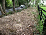
124 viewsRaford road was built along the filled-in fosse of a Turoe/Knocknadala oppidum linear embank-ment. Many oppidum embankment outer-lips were preserved as road boundaries (as above).
|
|

113 viewsThe new M6 motorway cuts through Greyford's (Ath Chlaidh) overgrown linear embankment E of Athenry near Esker (see intact dyke in centre photo of previous photo set) under a brazen cloud of denial that it bulldozed any vestiges of the many Turoe/Knocknadala oppidum trappings along its route into the dustbin of history.
|
|
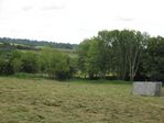
90 viewsThis double-ditch embankment (across the foreground) of a dyke set through Beech Hill forms a field fence in an area where numerous vestiges of linear embankments still survive.
|
|
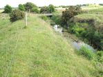
69 viewsEmbanked Doosigh River in Bellayarhag (Bel Dha Dherga) just south of Turoe. King Conaire Mor's assassination in the palisaded Bruiden Da Dherga (Da Derg's hostel - top righ corner) was literally fictionally transferred to a Tara setting by 9th century pseudo-historians. Gravel mining very recently demolished its major salient segment.
|
|
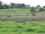
66 viewsVestiges of linear embankments in Claidh-Sceach an Annagh which gave the Townland its name. A transverse dyke runs from a lower dyke across that on the hill brow to another on the far side.
|
|
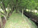
65 viewsNumerous oppidum linear embankments on the banks of small streams and rivers have been preserved almost intact similar to this example along the Turoe/Knocknadala inner ward.
|
|
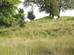
65 viewsTuroe oppidum's linear embankments took advantage of any topographical feature that could enhance their defensive strategy. This Killabeg set follows the curve of a hill brow.
|
|
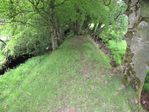
64 viewsThis built-up riverbank embankment above a small stream running through Carnakelly North served as a transverse dyke across a set of out-er ward linear embankments through the area.
|
|
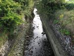
63 viewsDunbulcaun's Ath Clee Magh Ri great Iron Age seaport's monumental 2000 year cut and stone revetted rivers into the now drained longship-haven Seafield and Ballynamanagh lakes are in danger of collapsing or being robbed of their stonework (segments have already collapsed)
|
|
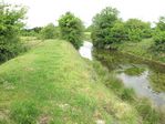
62 viewsLarge raised embankments along Raford ('Dur') River fitted with floodgates to flood extensive areas & enhance oppidum defences in time of danger is part of a set of linear embankments.
|
|
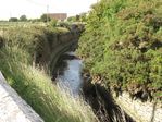
60 views2000 year old cut-stone reveted Bally-na-Managh River, an unspoilt, unprotected, monument to the Celtic Manapi (Managh) seamen who popula-ted Ath Clee Magh Ri's Iron Age seaport near Clarinbridge and wintered the longships there, may soon suffer the same fate as other similar segments robbed of their fine stonework.
|
|
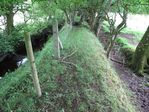
58 viewsThis intact embankment along a stream in Kiltulla North with a pathway (Ladies Walk) on its outer rim is typical of numerous embanked streams incorporated into the Turoe oppidum system.
|
|
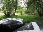
57 viewsA Beech Hill linear embankment became an official right-of-way when its fosse was filled from cutting the insides of the inner & outer dyke. A section wired off to store bailed hay.
|
|
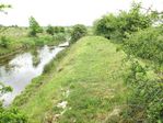
55 viewsNumerous rivers were incorporated into the defensive system of linear embankments and fitted with floodgates to flood large areas as here in Bel 'a Dheirg (Bellayarhag South).
|
|
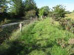
53 viewsNumerous roads were laid out along the fosse of the linear embankments filled up with earth from the partial cutting and lowering of the outer and inner banks, like this one in Killabeg
|
|
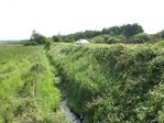
53 viewsThe hight of this road running through Lisduff (-doobh = dykes) into Kilcullia built on the surface of the dyke of a linear embankment of a Turoe oppidum outer ward is clearly visible here.
|
|
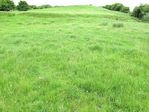
52 viewsCruachu Culainn, Culann's smithy/hostel. King Conor Mac Nessa took Setanta to Feis Temhro. As Setanta came late to Culann's feast, a huge hound attacked him. He slew it but guarded the fortress until another was found. Hence his nick-name, Cu Chulainn. A mound there held a skele-ton of a huge hound with bronze collar & chain.
|
|
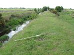
51 views'Moots'/'Mota' (a word for dykes in SE Galway) on Aughrim's River embankment set. Aughrim's Moat Tld., Woodlawn's O. Irish name, 'Mota', & many other 'Mota' tlds. are named from these.
|
|
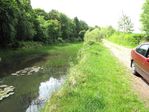
51 viewsMoneen Roo linear embankment road (lakelet in fosse) into Suck Valley on Sliabh Murri (Bru Mic Cecht Da Reo) NE slope near Creggs, NE Galway, an area of many linear embankment vestiges
|
|
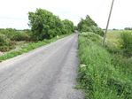
49 viewsAnother narrow road laid out on the surface of the linear embankment running along the edge of Pump Bog which formed the inner ward and east boundary of Knocknadala royal complex.
|
|
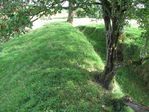
48 viewsThis embankment on the brow of a hill required only a modicum of effort to turn it into a formid-able barrier and is typical of many similar hill slopes incorporated into this defensive system.
|
|
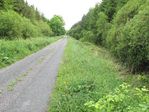
48 viewsNumerous long narrow roads were built on the surface of linear embankments along the outer wards of Turoe oppidum, like this example through Bellayarhag South. They had previously been used down through the centuries as local right-of-ways with their own specific landlord bylaws before being upgraded to sealed roads.
|
|
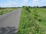
47 viewsA narrow road laid out on the surface of the main dyke of an outer ward linear embankment running through Cahernagarry just south of Turoe continued straight on into Carrowmore.
|
|
|
|