|
|
|
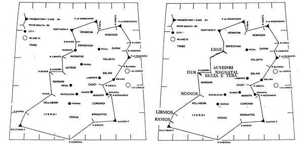
Ptolemy's 1st/2nd cent. 'Map' of Ireland
|
|
The incorrect clockwise reading of Ptolemy of Alexandria's (c. 100 A.D.) West of Ireland data (left) as generally, albeit erroneously, accepted by many authorities, contrasted here with an amended, fully recognizable, West of Ireland map, with all data in correct order based on a rational left-to-right, top-to-bottom, reading of Ptolemy's record (right). The misplacing of the Shannon and Dur (Dughiortach/Dunkellin) River mouths are the key to the correct reading.
|
|